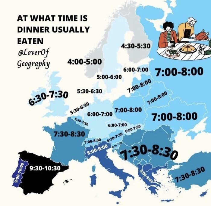
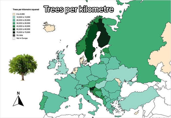
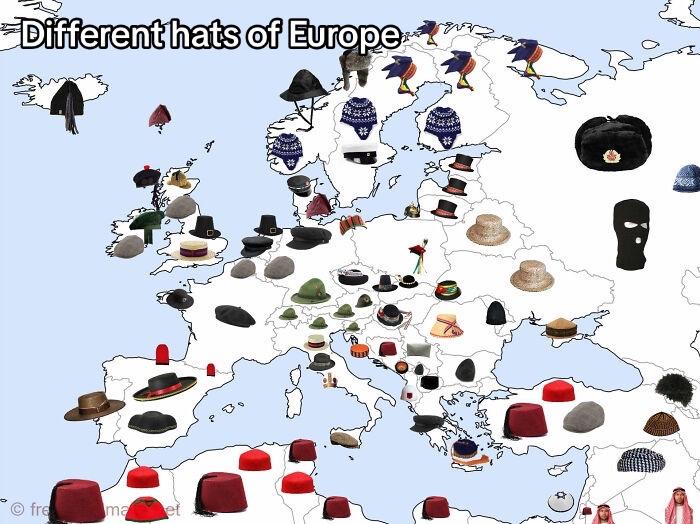
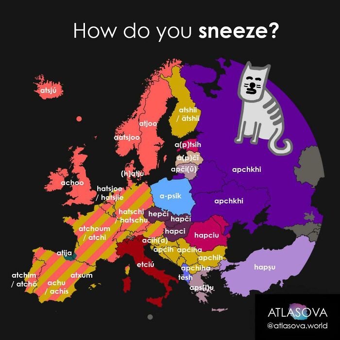
We all have geography lessons in school. And while we learn many interesting things about the maps and geography in them, there's always room for improvement.
So, today, let's look at these interesting maps of Europe that we picked and found online. After all, there's no wrong time to learn something new. And who knows, maybe you'll end up using these facts somewhere (maybe a trivia night?), unlike some things you were taught at school.
More info: TikTok
This post may include affiliate links.
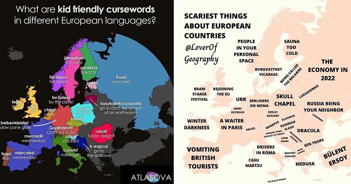
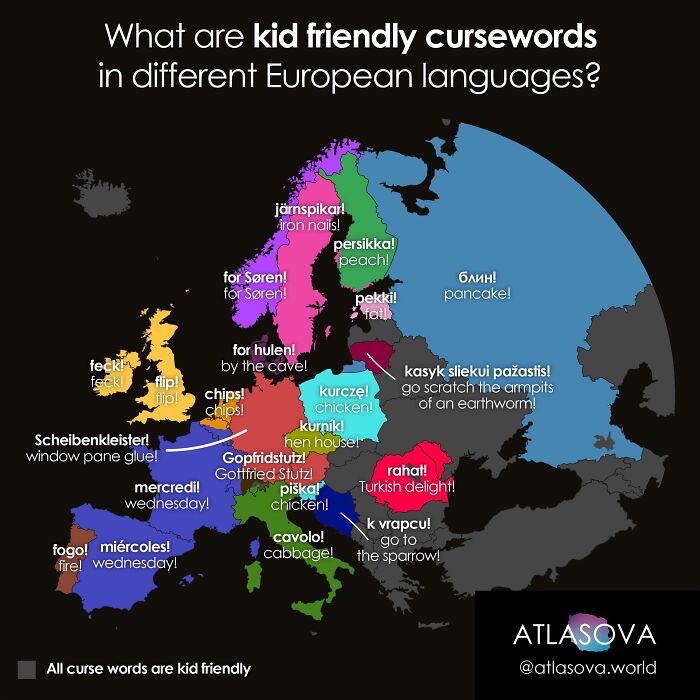
Mer..credi! in France because you start to say Merde! and realize there are kids around ;-))
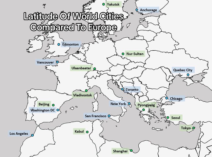
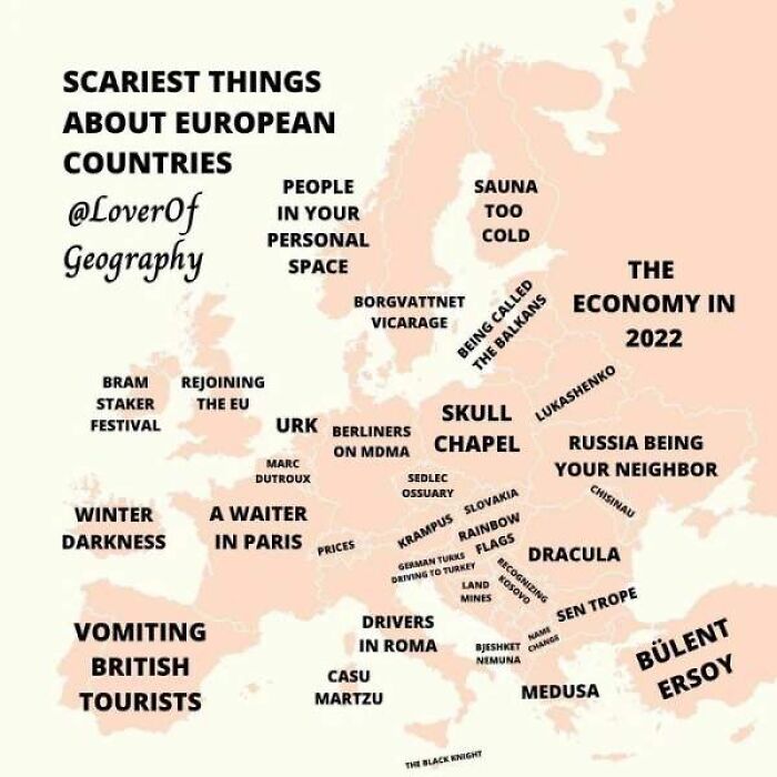
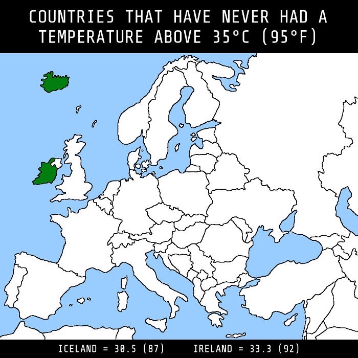
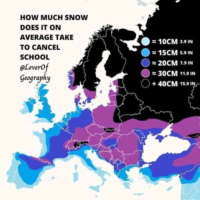
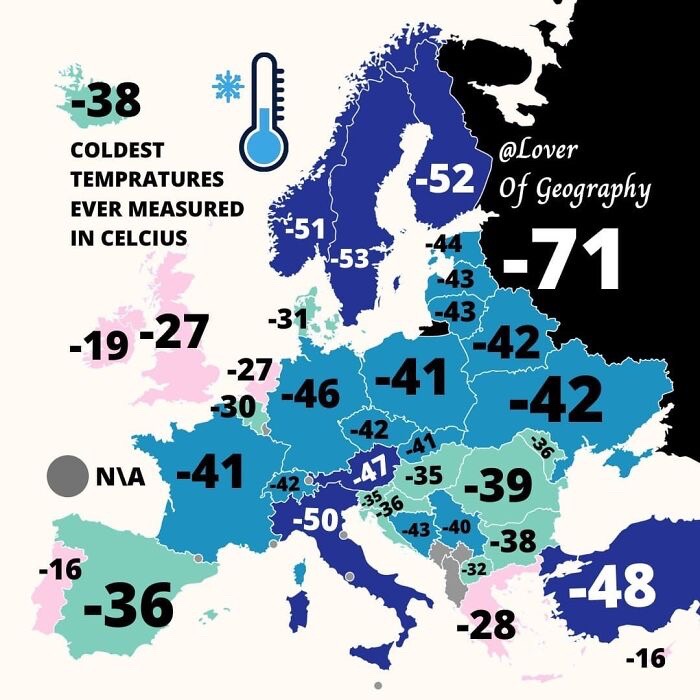
This one is both fascinating and quite scary. The relatively mild climate in the British Isles is, as I understand it, heavily reliant on the Gulf Stream. If that gets messed up because of climate change, we're fűcked!
Maps are leading us in nearly every step of our way. They are reachable to everyone - just a few presses and you can see Google or Apple Maps. But that wasn’t always the case.
The history of maps can be traced as far back as 5000 years ago. The first-ever maps were used to depict small areas in pictures. And there was no set of rules on how everything should be drawn, which made maps quite inaccurate.
Later, the map-making art was taken over by the Greeks and Romans. The most notable works of this mapping period were those of Claudius Ptolemaeus. He was a geographer, mathematician, and astronomer, who came up with longitude and latitude lines. And, well, that revolutionized European geographic thinking.
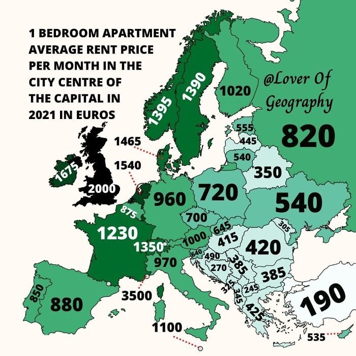
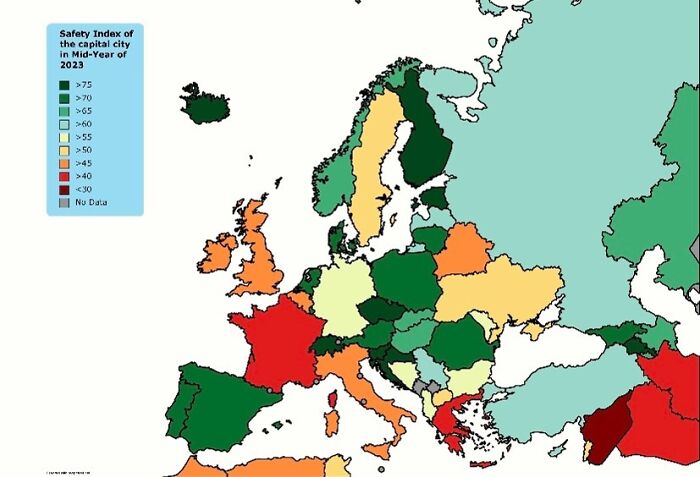
Ha, jokes on switzerland, the biggest, most popular and most expensive city isn't even the capital.
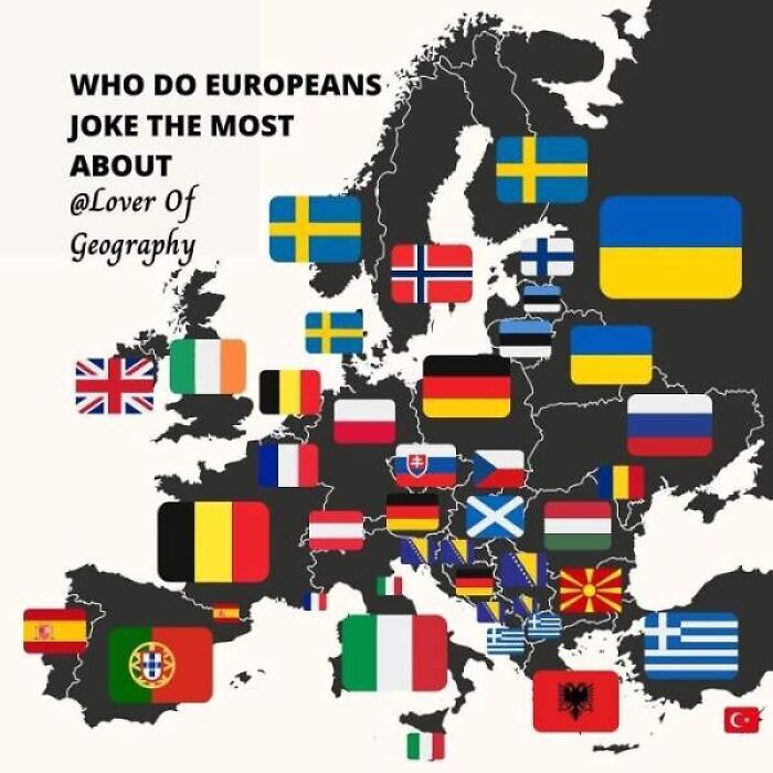
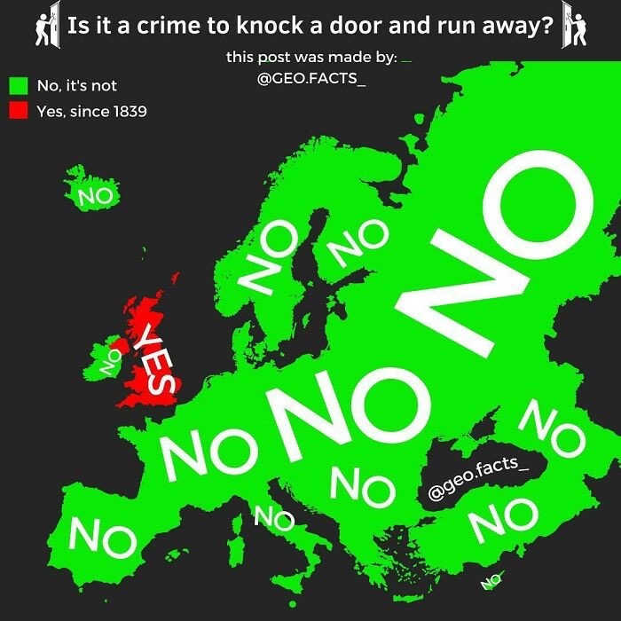
Milton Jones: why did I run up to doorbells and ring them, then run away? Just for the buzz...
Then, during the middle ages, there wasn’t much progress in the map-making scene. Most of the maps that were produced during this time were of monasteries, which were influenced by religious devotion. They were heavily decorated with angels and imaginary monsters.
However, the Islamic world made some progress in the map-making area. The most notable instance is of Al-Idrisi, an Arab scholar who produced numerous world maps and geography books that heavily influenced this scientific field.
After the Middle Ages, the invention of the printing press by Johannes Gutenberg pushed the monasteries out of the dominance of map production. Also, the printing process becoming more available resulted in the growth of major publishing houses. And they produced maps that were accessible to everyone, no matter their financial status.
Even more, improvements in mapping were brought about by the accessibility of public learning and the thirst for knowledge. Increasingly, maps started having more colors showcasing various aspects of the presented place.
Also, in the late 1700s, thematic maps started showing up; for example, those showing the spread of certain illnesses or the extent of a flood.
Now, the maps on our phones are made by using satellite systems and surveying techniques. With these tools, cartographers can measure everything with precision, which was never achievable before. And due to their precision, maps have become an irreplaceable aspect of nearly everyone’s life.
Did you learn something new from these maps? Share your discoveries with us in the comments!
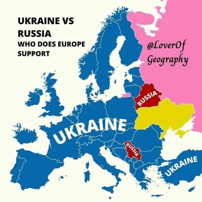
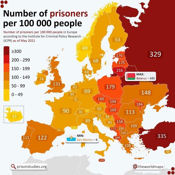
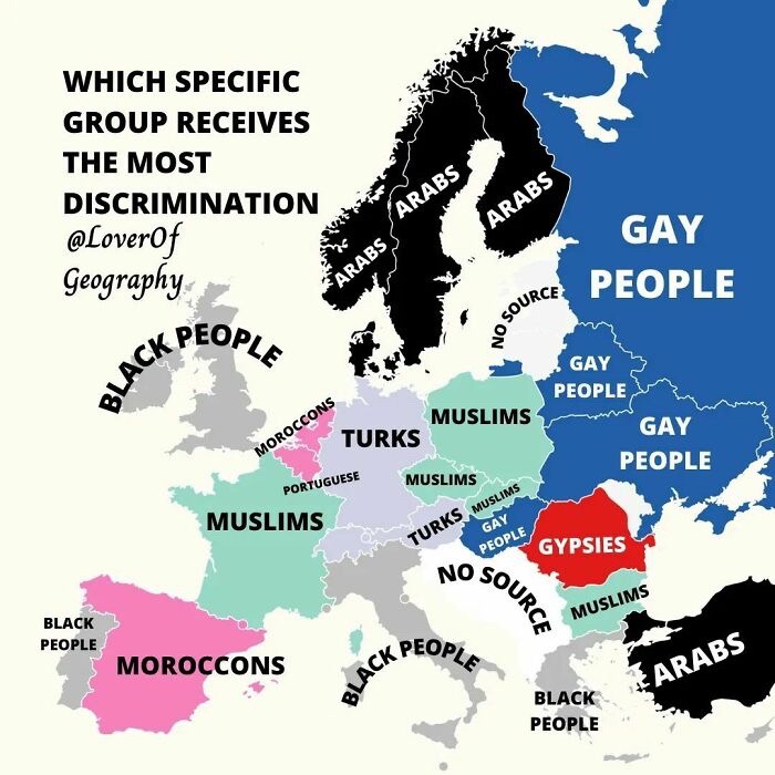
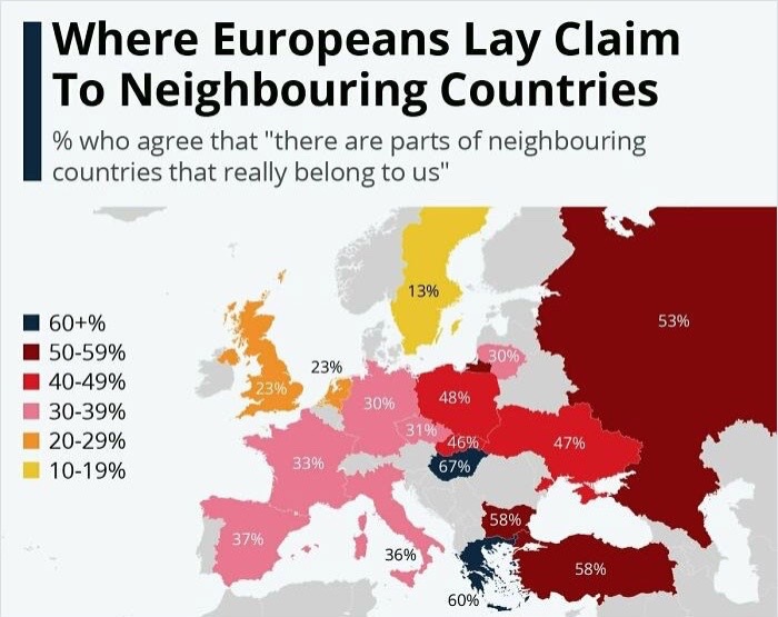
Oh Dear, if this all goes tits up, I'm pretty sure Russia will go down the pan - so then it's goodbye Belarus and Serbia.
Prout in French, parp in English? pum in Spanish?
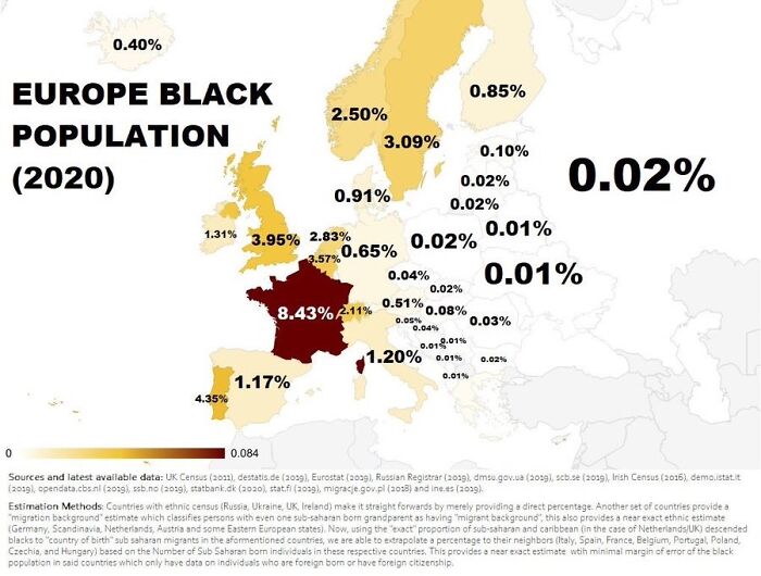
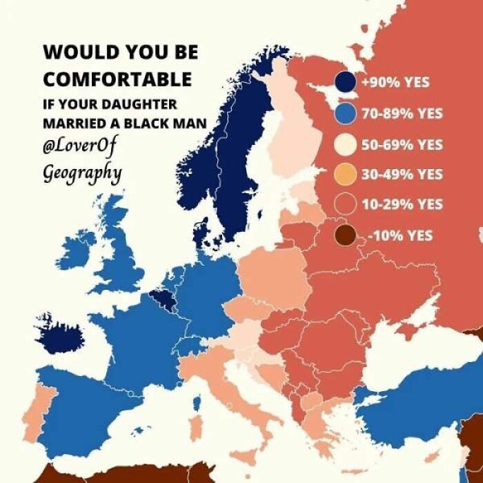
Load More Replies...Fun short story. Company that outsourced to Switzerland wanted to enforce their policy to have at best 50% black workers, and then got very surprised and confused why this wasn't feasibly possible
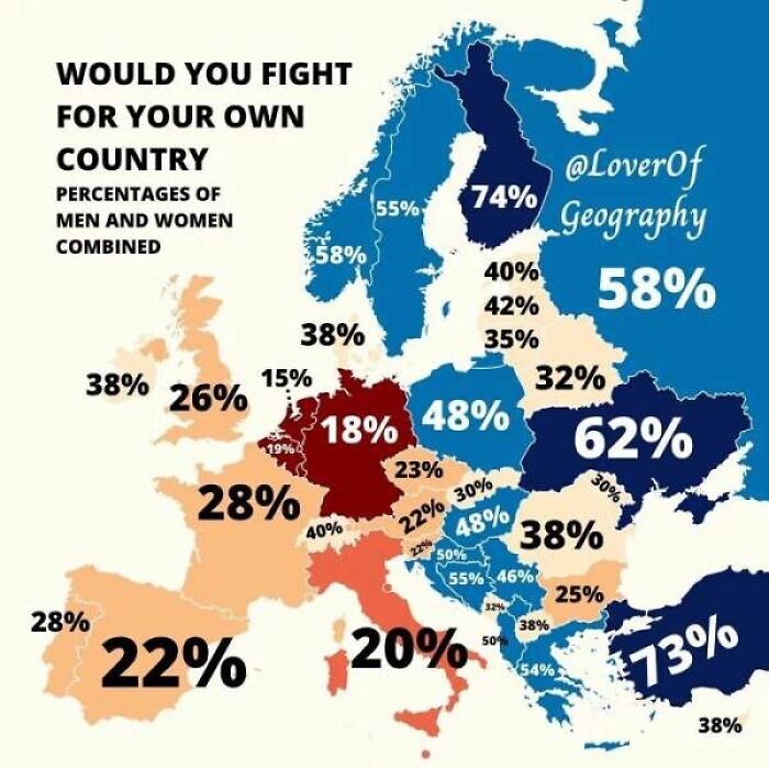
For my country, yes ; for the cretins that run my country, no ; those people I'd rather put them in a hole in the ground and just fill it in whilst they're alive. Wars are not started by the people of a country, they are started by upstarts, despots and chancers using those people to fulfill their own deluded ambitions - think Putin and Netenyahu at the moment ; they won't win and people on both sides of their particular countries will suffer because of those two idiots unachievable delusions.
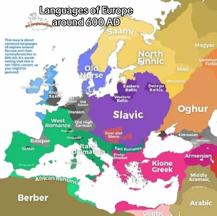
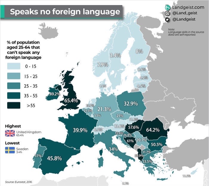
Depends on your definition of "speaks". UK schools teach foreign languages (which and whether it was compulsory varies over the years). However, they start late and are not very advanced by the time they finish. I did both French (5 years) and German (2 years) and I speak neither with any fluency.
Interesting maps.. but none of this stuff is really important for school
There are so many facts wrong in this article that I would suggest deleting the entire thing, rather than trying to fix every mistake
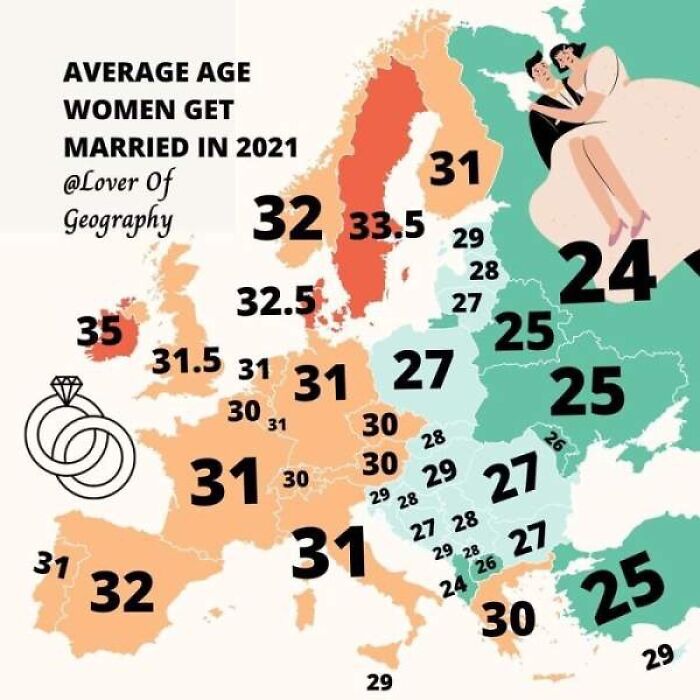
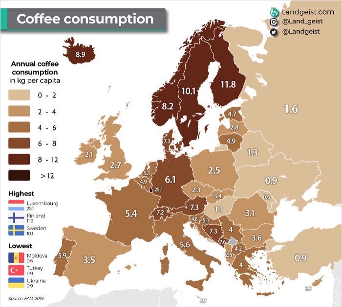
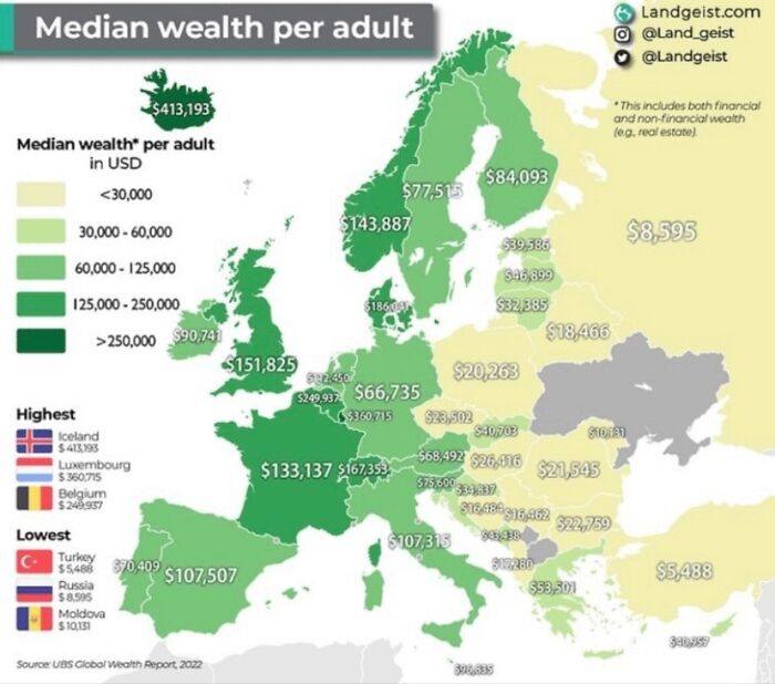
I think this is per household, not per adult. Oops, I meant to comment on the last post, not general.
Wondering when those map creators will realize, that Turkey and Russia are Asian countries, not European. Far more than 50%, even more than 70% of their territories are on the Asian continent. So clearly not European.
Russia is both Turkey and can't make its mind up. Not everything depends on an arbitrary line on a map or someone's definition of a continent.
Load More Replies...Interesting maps.. but none of this stuff is really important for school
There are so many facts wrong in this article that I would suggest deleting the entire thing, rather than trying to fix every mistake
I think this is per household, not per adult. Oops, I meant to comment on the last post, not general.
Wondering when those map creators will realize, that Turkey and Russia are Asian countries, not European. Far more than 50%, even more than 70% of their territories are on the Asian continent. So clearly not European.
Russia is both Turkey and can't make its mind up. Not everything depends on an arbitrary line on a map or someone's definition of a continent.
Load More Replies...
 Dark Mode

 No fees, cancel anytime

