Recently, the United States seemingly can't get a break from natural disasters. Just a short time ago, the tragic hurricane Helene hit the country, and now a new hurricane is on its way.
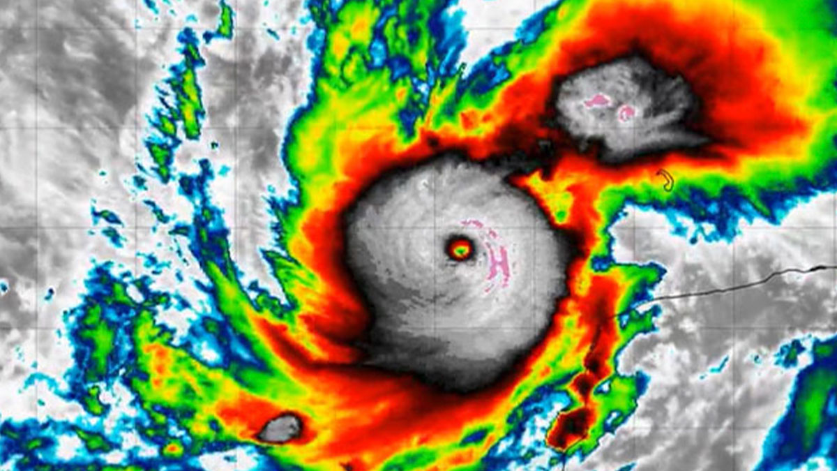
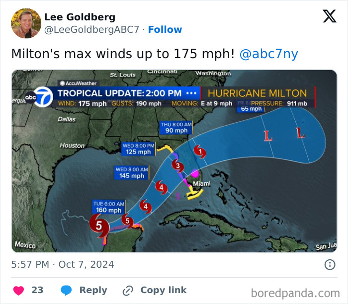
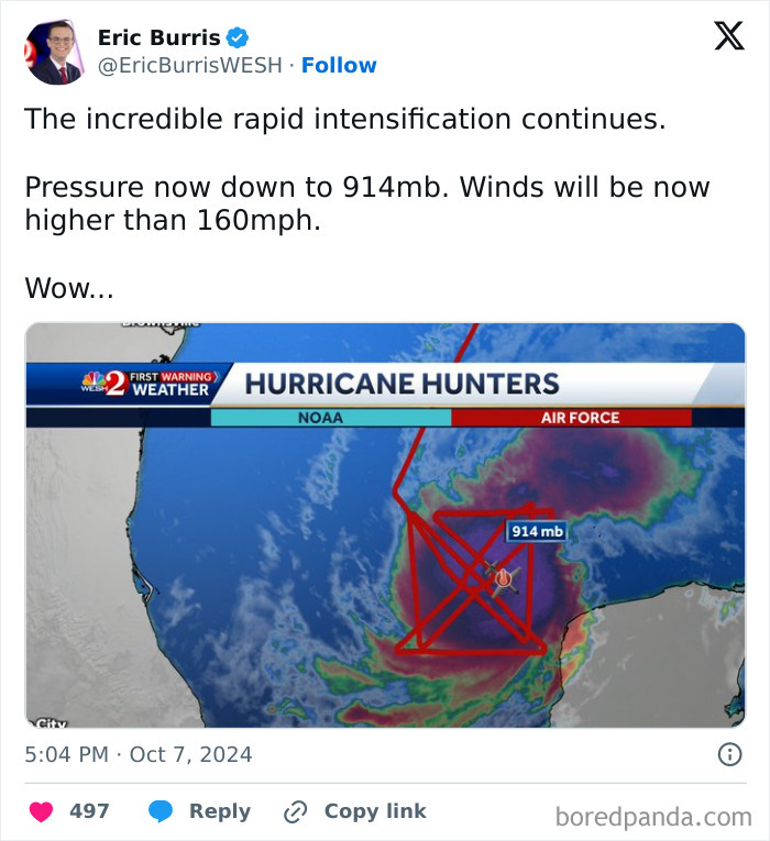
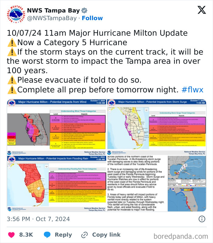
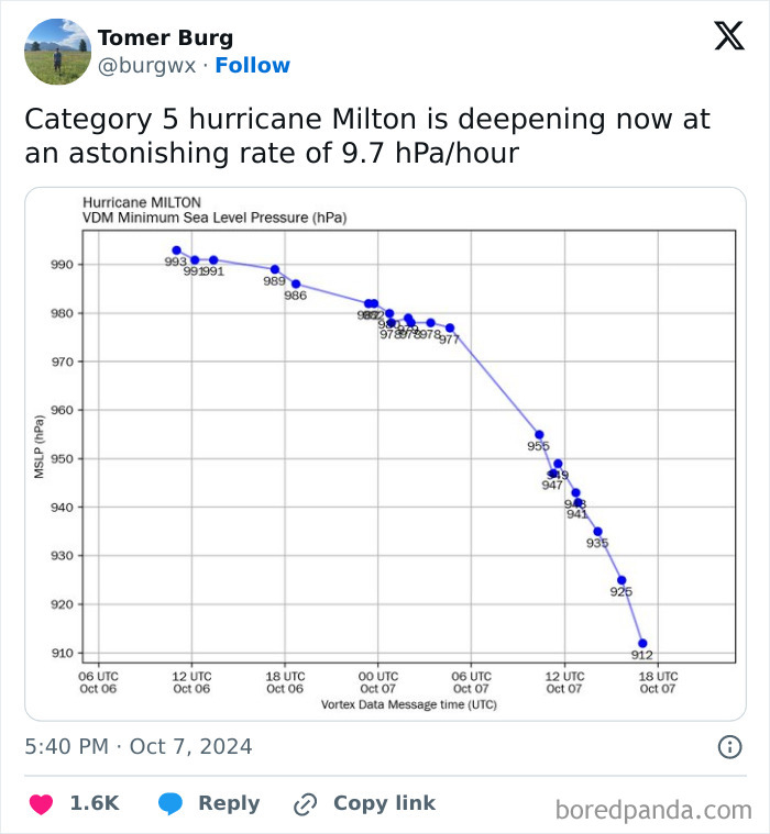
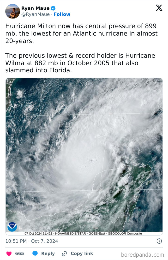
In 24 hours, Hurricane Milton was upgraded from a tropical storm to a Category 5 hurricane, and it is now expected to hit Florida either on Tuesday night or early Wednesday morning. Experts online are sharing facts about how scary this natural disaster is and are urging people to evacuate as soon as possible.
This post may include affiliate links.
At the end of September of this year, Hurricane Helene was happening in the country, more specifically, the southeastern part of it.
The catastrophic Helene caused many tornadoes and rainfall-triggered flooding, particularly in western North Carolina, eastern Tennessee, and southwestern Virginia. Over 200 lives were lost due to it.
It was the strongest hurricane on record to strike the Big Bend region of Florida, the deadliest Atlantic hurricane since Hurricane Maria (in 2017), and the deadliest to strike the US mainland since Hurricane Katrina (in 2005).
Now, another natural disaster is happening in the United States. It’s called Hurricane Milton and it’s happening in the Gulf of Mexico.
it might not though. like how in 2014 we were like 'omg WARMEST YEAR ON RECORD' and this year it looks like it'll be dropping out of the top 10 (yes the top 10 warmest years are just the past ten, I'd add links but it turns out the NOAA website responsible is in Asheville so it has a bunch of pages that are down, it also looks like 2024 is going to break 2023's record and I think we're now in month 15 of record breaking monthly temperatures...)
On October 4, 2024, the National Hurricane Center posted on their X account (formerly Twitter) that they were monitoring the area in the Gulf Of Mexico and that it had a medium chance of developing in the next 7 days. The next day, they were slowly reporting on the tropical storm that was dubbed Milton. Then, on October 6, they posted that Florida residents should prepare for it, replenish their supplies, and not forget their pets.
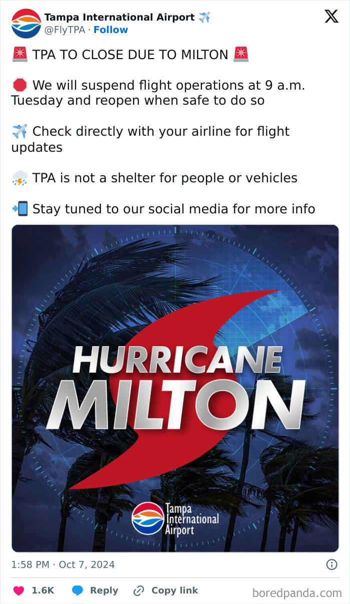
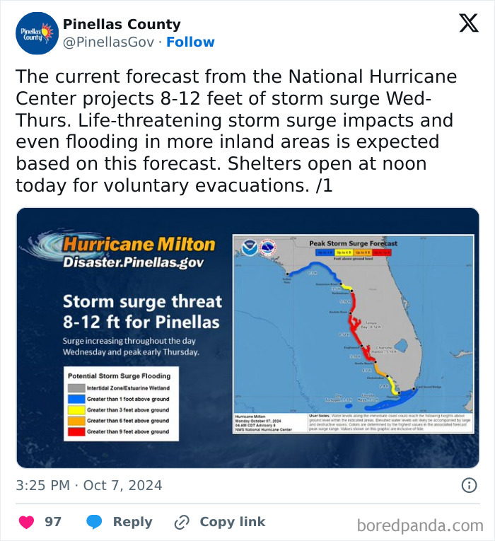
A bit later that same day, Milton was upgraded to a hurricane and was reported to intensify rapidly. The next day, October 7, the account retweeted NHC Storm Surge’s tweet about the increasing risk of Milton for portions of the west coast of the Florida Peninsula beginning Tuesday night or early Wednesday.
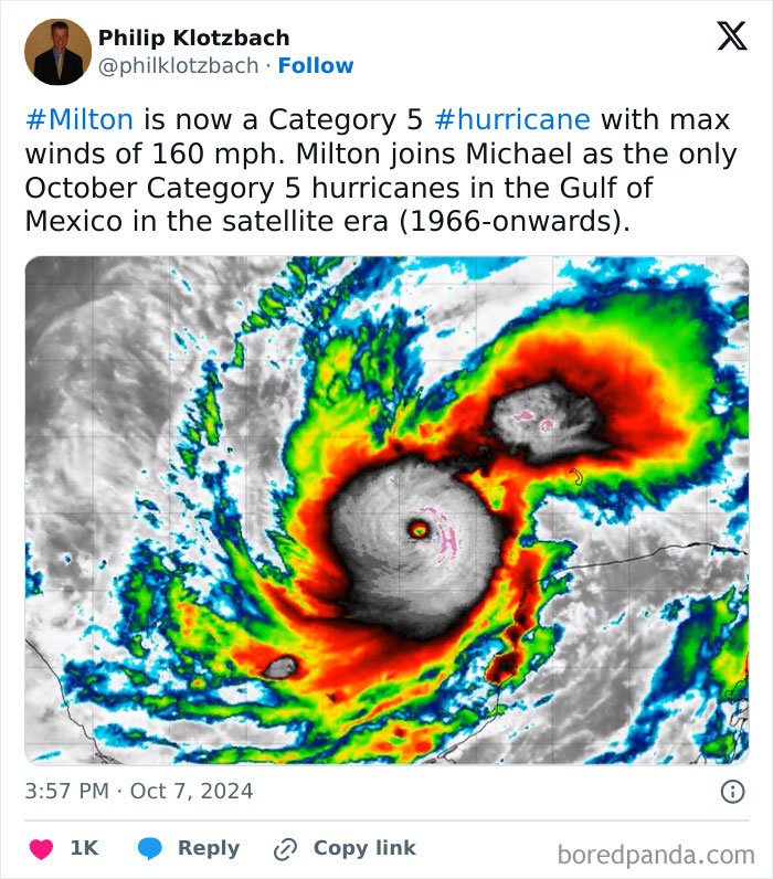
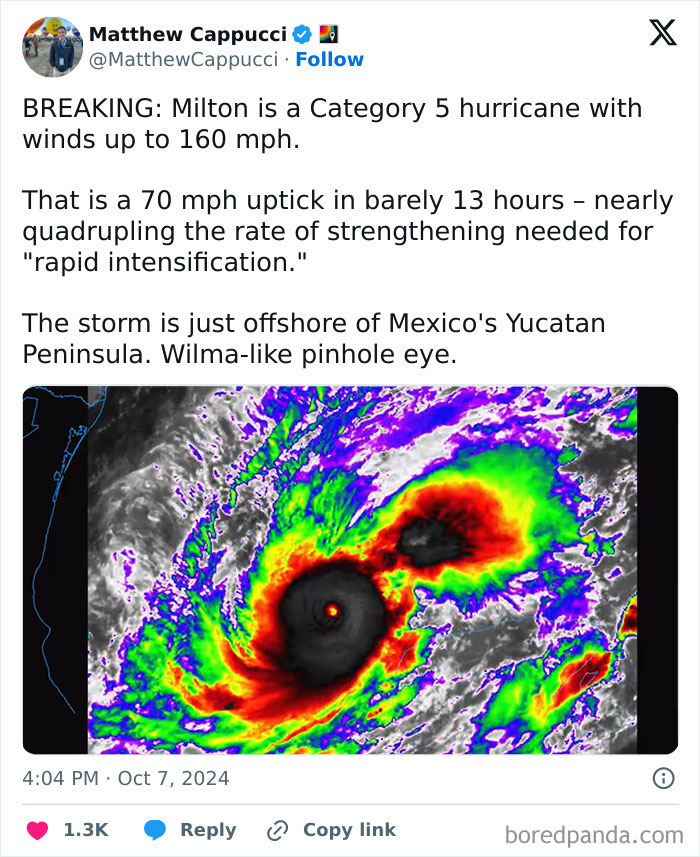
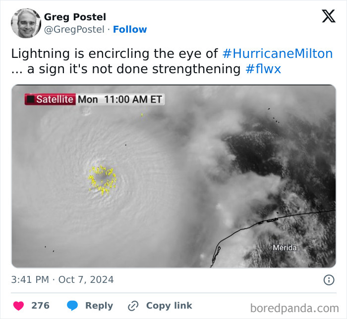
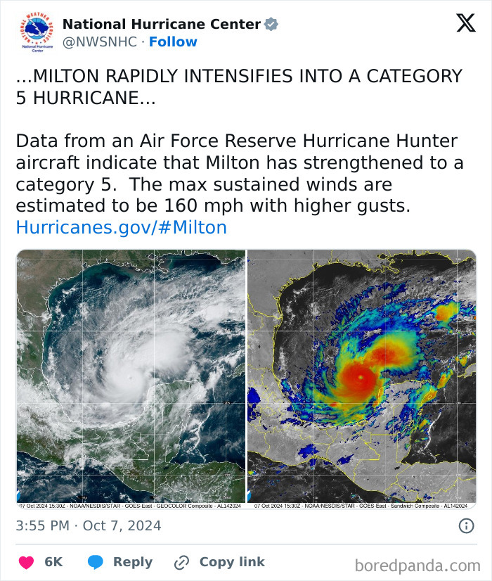
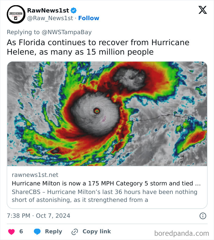
Then, every couple of hours or so there were updates about Milton intensifying even further. It was upgraded to a Category 3 hurricane, then 4, and finally 5.
I've reading this tread waiting for LOTR references... Where are my hobbits!
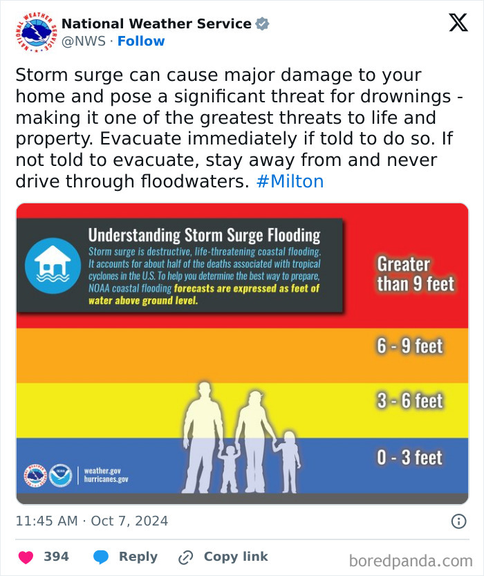
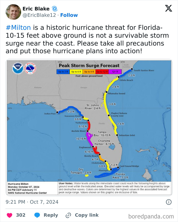
A Category 5 hurricane is the highest the natural disaster can be. It means that winds are greater than 155 mph, while the storm surge is greater than 18 feet (around 5.48 meters) above normal tide. This requires massive evacuation of residential areas on low ground within 5 to 10 miles (around 8 to 16km) of the shoreline.
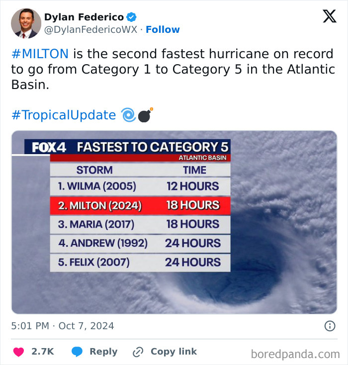
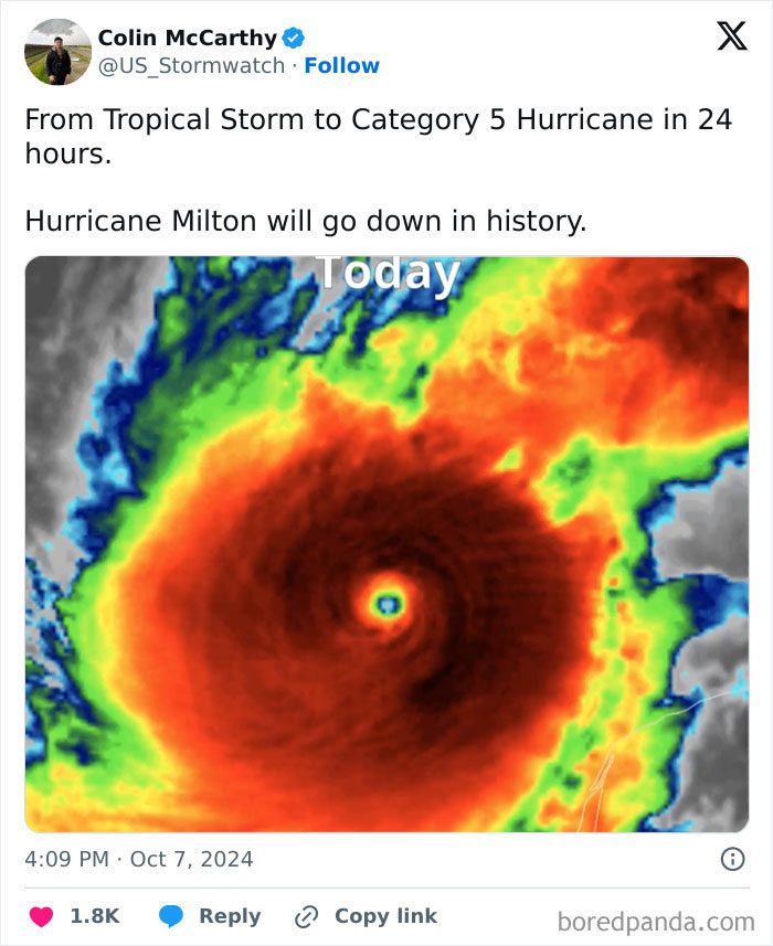
Storm chaser Colin McCarthy said that “Hurricane Milton will go down in history” as it went from a tropical storm to a Category 5 hurricane in only 24 hours. Also, meteorologist Dylan Federico pointed out that Milton is the second fastest hurricane on record to go from Category 1 to Category 5 in the Atlantic Basin.
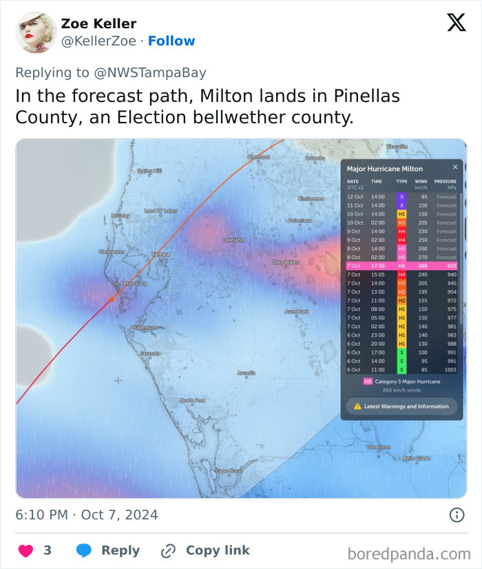
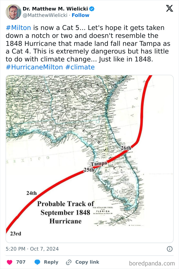
If it stays on the expected course, it’s going to be the most powerful hurricane to hit Tampa Bay in over 100 years.
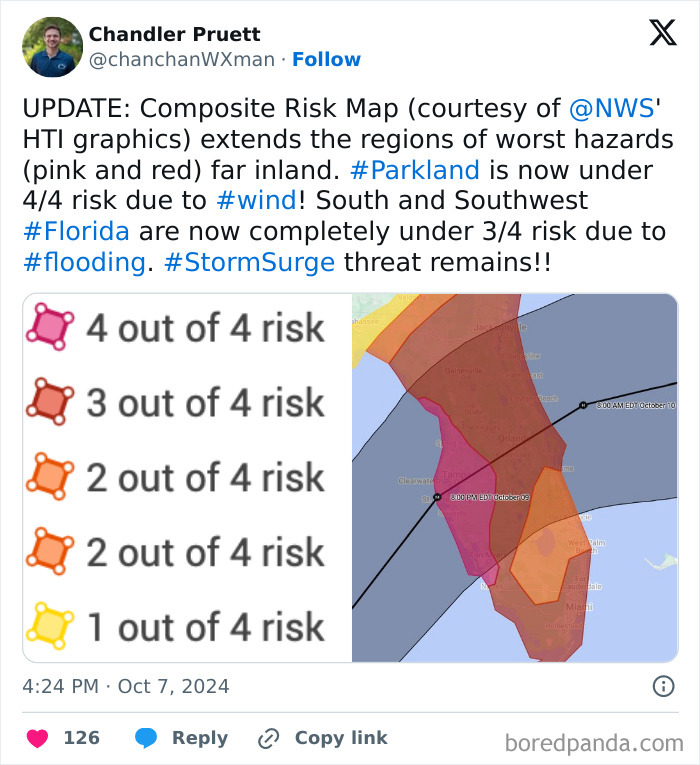
This visual is frightening. I haven’t prayed since 9/11. I think I’ll pray tonight for the people that could not evacuate. May their Guides be with them through this.
There are many people who cannot evacuate for health reasons. Then there are the people who tried to evacuate but their vehicle broke down or there is literally no gas at gas stations.
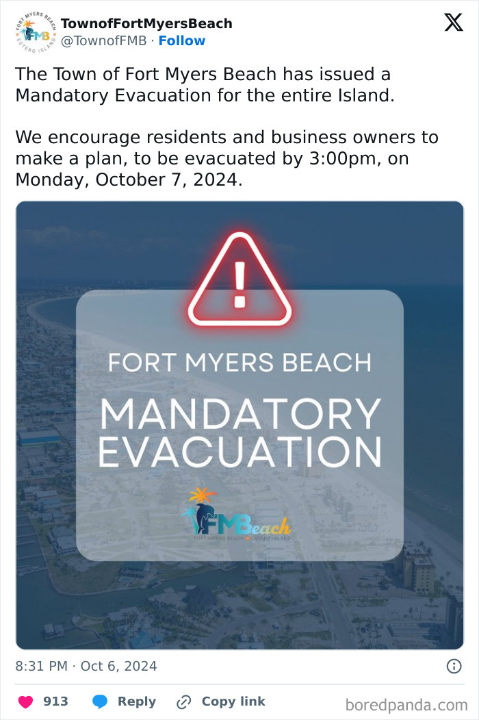
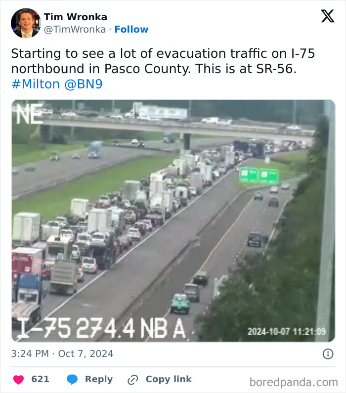
So, it’s no surprise that many people are trying to evacuate the places that are on Milton's course. A steady stream of vehicles is headed north toward the Florida Panhandle. Traffic is clogged on the southbound lanes of the highway as some residents are heading for the relatively safe Fort Lauderdale and Miami.
By Monday morning, some of the gas stations in the Fort Myers and Tampa areas had already run out of gas.
At this point, since the hurricane is still active, more news will follow. If you're in or near the potentially affected areas, please evacuate to safety.
It does not have “little to do with climate change”. Yes natural disasters have always happened, and yes there have always been some bad ones, but never this many this fast with this intensity and this much devastation. Climate change is ABSOLUTELY a massive contributing factor.
Hope it's not as bad as predicted. But you just know there are newspaper editirs going to send their photographers out to get before and after pictures so they can use the headline "Paradise Lost"
Load More Replies...It's been wild watching the monitoring of this beast. So many services track it and end up with different predictions. Two days ago they were predicting everywhere from cat 1 to cat 5. The variables are endless and it's impressive that they can even put it together. One facet I thought interesting was the water temperature in the gulf. Overall it's very warm water, but one graph showed this massive hotspot lying between where the storm was and Florida. Just this big red blur on the way. I don't even know how that variance impacts things but it just looked ominous.
The "European model" for the forecast is usually the best. But there is really no question that this is going to hit people hard.
Load More Replies...Hope it's not as bad as predicted. But you just know there are newspaper editirs going to send their photographers out to get before and after pictures so they can use the headline "Paradise Lost"
Load More Replies...It's been wild watching the monitoring of this beast. So many services track it and end up with different predictions. Two days ago they were predicting everywhere from cat 1 to cat 5. The variables are endless and it's impressive that they can even put it together. One facet I thought interesting was the water temperature in the gulf. Overall it's very warm water, but one graph showed this massive hotspot lying between where the storm was and Florida. Just this big red blur on the way. I don't even know how that variance impacts things but it just looked ominous.
The "European model" for the forecast is usually the best. But there is really no question that this is going to hit people hard.
Load More Replies...
 Dark Mode

 No fees, cancel anytime


