My name is Alex and I am a web developer based in Vienna, Austria. I was always interested in photography so that was basically a good start for my project.
I started with re-photography in 2011. I got a book with old pictures from my parents and was fascinated by how my hometown looked like in the past. All those places I was familiar with, the streets where I have grown up and etc. That looked so familiar but also so different at the same time. Have you ever wondered what a place looked like in the past?
So I decided to take pictures of those places in the exact angle and perspective to document those differences. Although I often hear that the city looked more beautiful in the past, I also want to show the things that have improved, like the building of pedestrian areas and etc.
More info: zeitenspruenge.at
This post may include affiliate links.
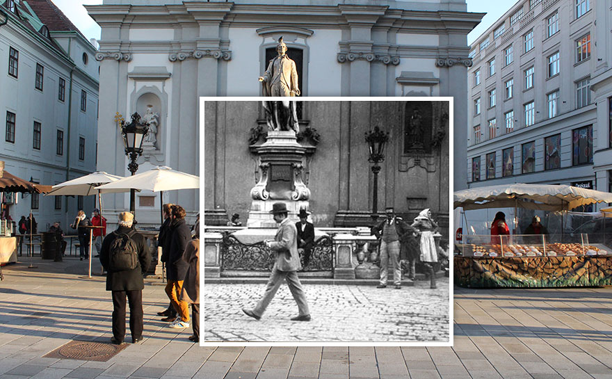
Street Scene On Mariahilfer Strasse 1900 vs. 2016
Mariahilfer Strasse, a famous shopping street.
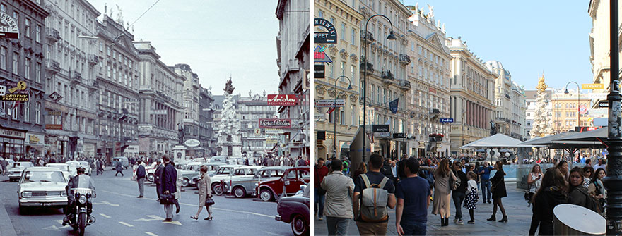
Graben 1966 vs. 2018
The main tourist area in the city center of Vienna is now a pedestrian area.
Mariahilfer Strasse 1986 vs. 2015
This famous shopping street was transformed into a pedestrian area. The tram has been replaced by a subway line.
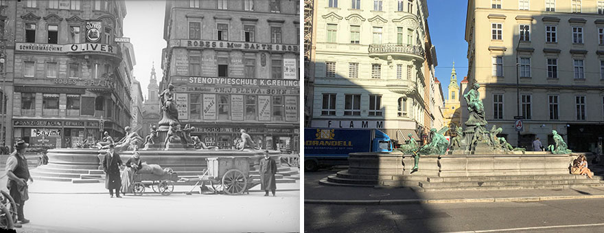
Neuer Markt 1910 vs. 2018
Who else loves those old commercials on the buildings?
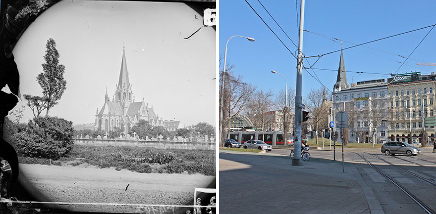
Gürtel Street 1874 vs. 2015
Now it is one of the busiest streets of Vienna, in the 19th century there was a cemetery.
Along The Danube 1980 vs. 2019
Vienna was hit by some major floodings, so the government decided to build a second riverbed along the main river. This picture also shows the rising skyline around the Vienna International Centre.
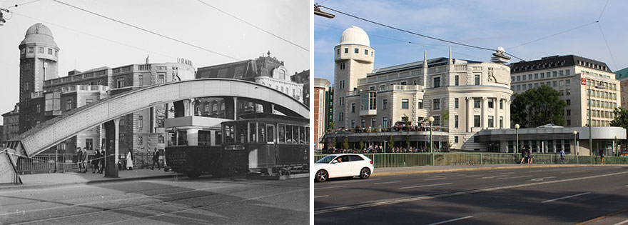
Urania Building 1930 vs. 2019
The Urania building and the old Aspernbrücke (bridge).
What purpose did that bridge serve. I'm surprised to see improvements in so may instances.
It was just an ordinary bridge connecting the first and the second district.
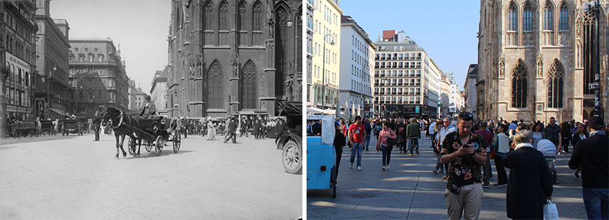
Load More Replies...Stephansplatz 1914 vs. 2018
The area around St Stephen’s was one of Vienna’s first pedestrian areas.
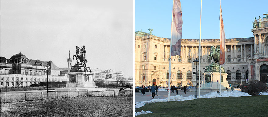
Heldenplatz 1880s vs. 2015
The old city wall was torn down in the 19th century, many iconic buildings were built along the new Ringstrasse.
These were awesome. I love seeing these kind of side to side historical photo series.
Thanks! If you are interested in more pictures, you can find them on www.zeitenspruenge.at
Load More Replies...Would it also be possible to create a photo series like this with scenes from the movie "The Third Man" on the left? I believe that movie was shot right after WWII, and it would be fascinating to see how well the city has been restored.
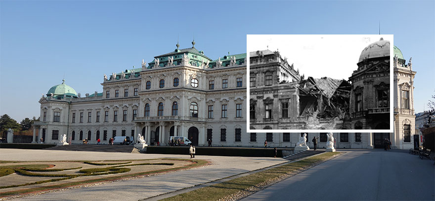
I don't have any pictures from the movie, but some of the 40s and 50s. For example: the destroyed roof of St.Stephen's (https://www.zeitenspruenge.at/bild/20), the partly damaged Belvedere (https://www.zeitenspruenge.at/bild/34), the destroyed Südtiroler Platz (https://www.zeitenspruenge.at/bild/331). Check out the website https://www.zeitenspruenge.at/ !
Load More Replies...These were awesome. I love seeing these kind of side to side historical photo series.
Thanks! If you are interested in more pictures, you can find them on www.zeitenspruenge.at
Load More Replies...Would it also be possible to create a photo series like this with scenes from the movie "The Third Man" on the left? I believe that movie was shot right after WWII, and it would be fascinating to see how well the city has been restored.
I don't have any pictures from the movie, but some of the 40s and 50s. For example: the destroyed roof of St.Stephen's (https://www.zeitenspruenge.at/bild/20), the partly damaged Belvedere (https://www.zeitenspruenge.at/bild/34), the destroyed Südtiroler Platz (https://www.zeitenspruenge.at/bild/331). Check out the website https://www.zeitenspruenge.at/ !
Load More Replies...
 Dark Mode

 No fees, cancel anytime















![“[Am I The Jerk] For Telling My Mom That It Was Very Obvious They Never Liked Me?”](https://www.boredpanda.com/blog/wp-content/uploads/2024/12/mom-relationship-drama-coverimage.jpg)


