17 Rare Pics Reveal A Fake Rooftop Town Built To Hide Boeing’s Factory From Japanese Air Strikes
During World War 2, one B-17 Bomber cost a little over $200,000 to produce. That’s about $3,4 million in today’s economy. And since the US Army requested thousands of these war planes, they wanted to take every measure when securing the Boeing factory that produced them. And by “every measure” I mean hiring Hollywood set designers to build a fake neighborhood atop it and getting actors to inhabit the area.
Protecting it from potential airstrikes, the movie prop “neighborhood” was constructed in 1944 and removed a year after the war. John Stewart Detlie was the Hollywood set designer who helped to hide the Boeing Plant No. 2. Using the same techniques as in movie towns, fake streets, sidewalks, trees, fences, cars, and houses were set in place to fool the would-be attackers.
Underneath it, 30,000 men and women were constructing about 300 bomber planes per month to support the fight against Nazis. Boeing B-17 Flying Fortresses dropped over 640,000 tons of bombs over Germany alone during the conflict, and of the 12,731 Boeing planes built, about fifty remain in complete form.
In the 1960s, the first Boeing 737s were assembled in Plant 2 but finished in the neighboring Thompson Site where the production of the 737 was eventually moved to. In the 1980s, the site was used as a machine shop but that discontinued as work shifted to more modern facilities. Ultimately, the structure fell into decay and in 2010, Boeing began the demolition of the warcraft plant.
(h/t vintageeveryday)
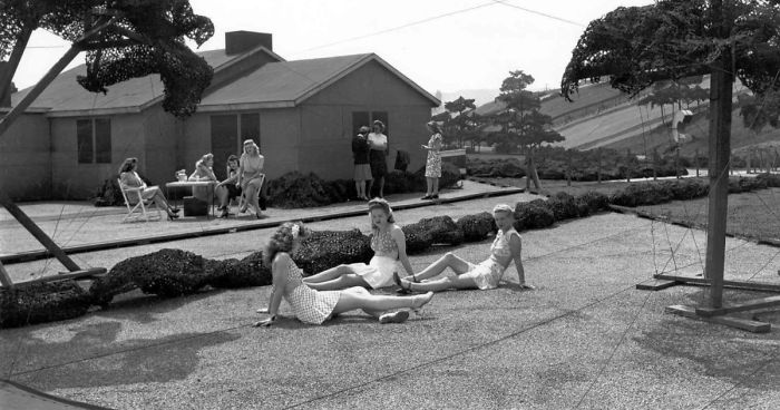
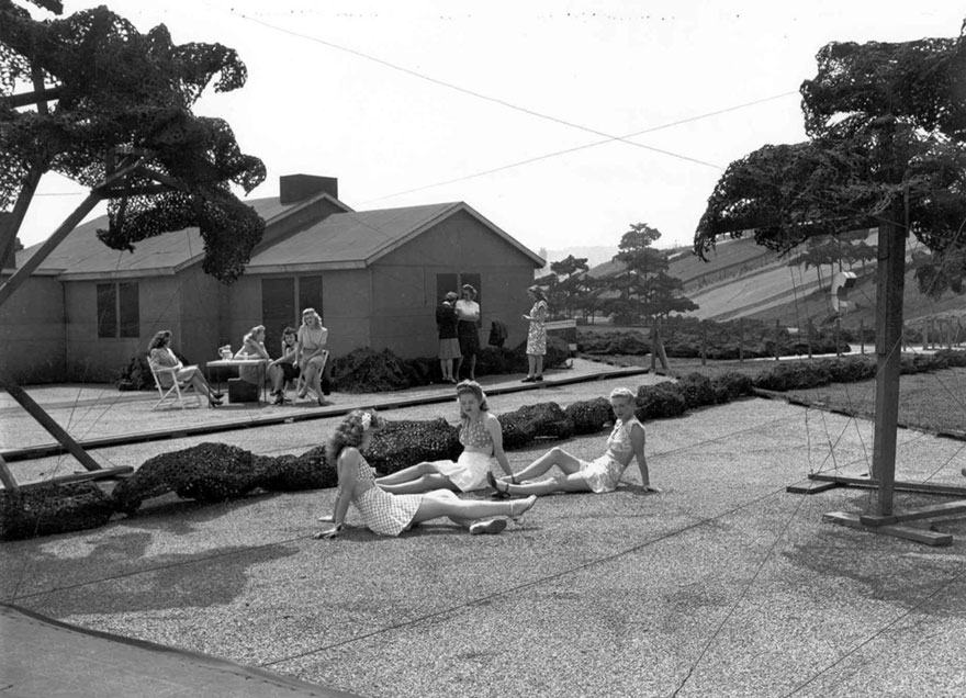
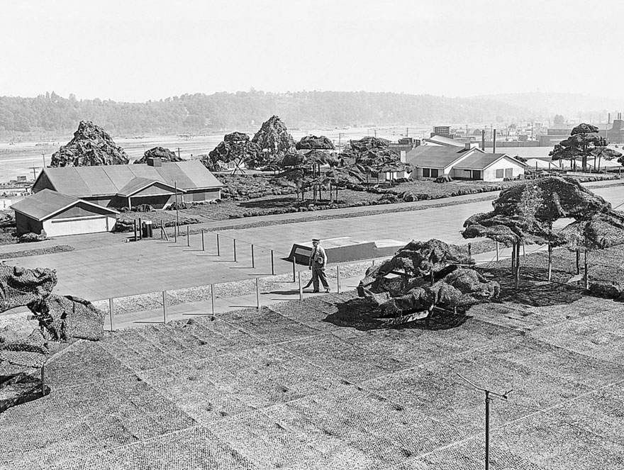
At first glance, this looks like an ordinary day in a small village with people enjoying the sun outside
Image credits: Seattle Times archive
But underneath this ‘peaceful town’ was a big military secret: a Boeing factory
During WWII, the U.S. Army designed a whole neighborhood to throw off possible air attacks
Image credits: Seattle Times archive
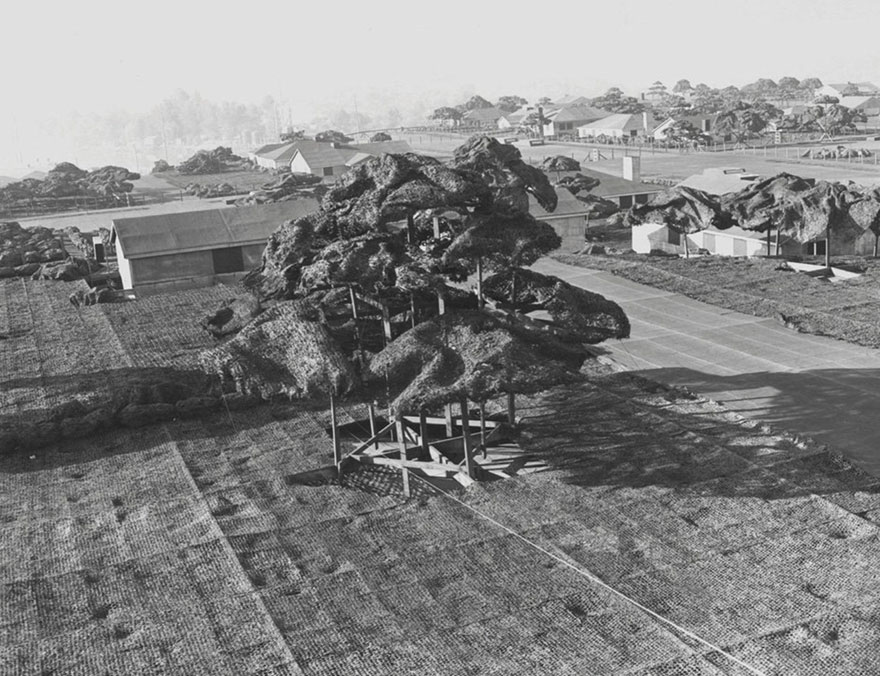
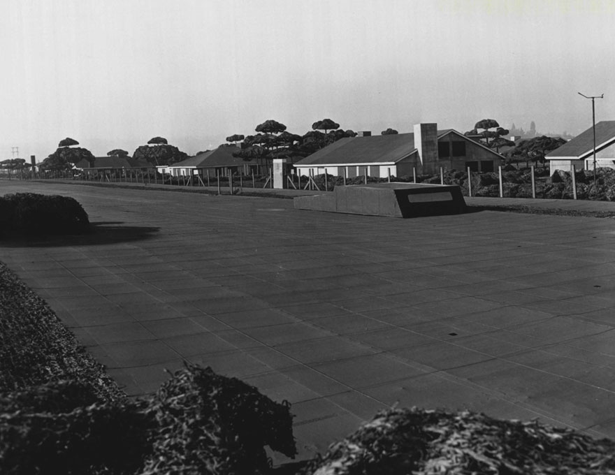
On the roof of Boeing Plant 2, camouflage trees and structures were shorter than a person
Image credits: Seattle Times archive
Trees were made of chicken wire and feathers
Image credits: Seattle Times archive
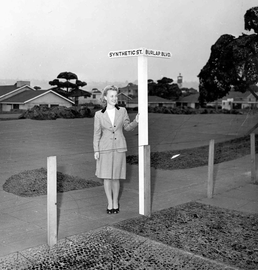
A street sign plays off the fake neighborhood at the corner of “Synthetic Street” and “Burlap Boulevard”
Image credits: Seattle Times archive
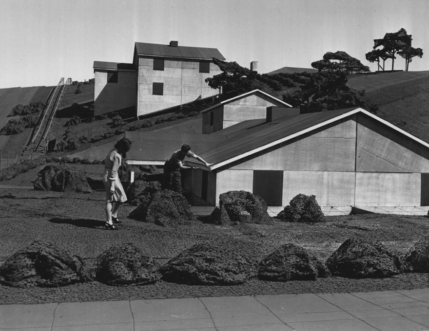
Suzette Lamoureaux and Vern Manion examine one of the miniature bungalows in the “Boeing Wonderland”
Image credits: Seattle Times archive
Structures that look like cars from overhead are parked along a fake street
Image credits: Seattle Times archive
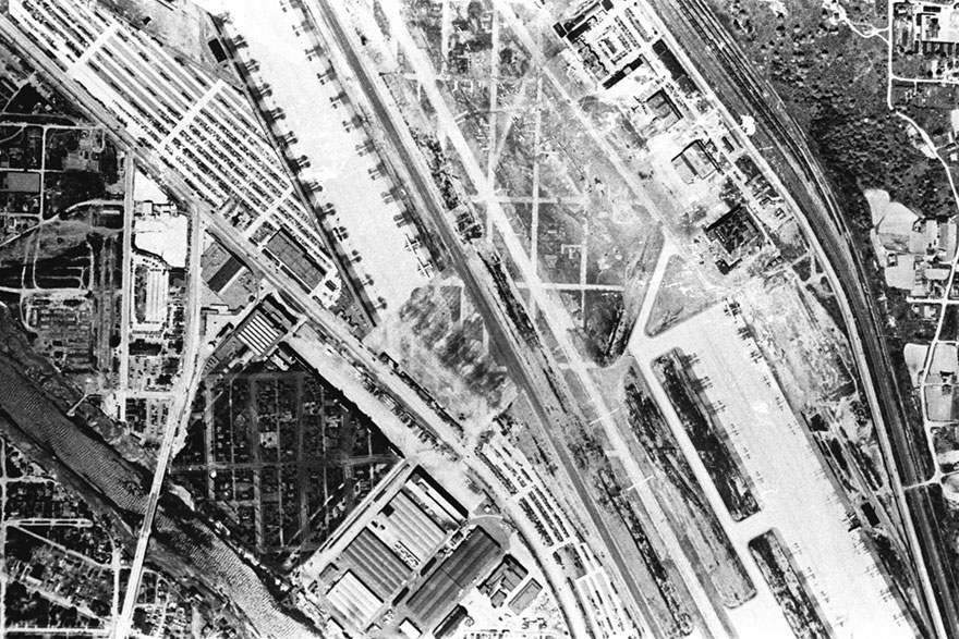
An aerial view of the camouflage on top of Boeing Plant 2 shows that the “streets” were aligned with real residential neighborhoods nearby
Image credits: Seattle Times archive
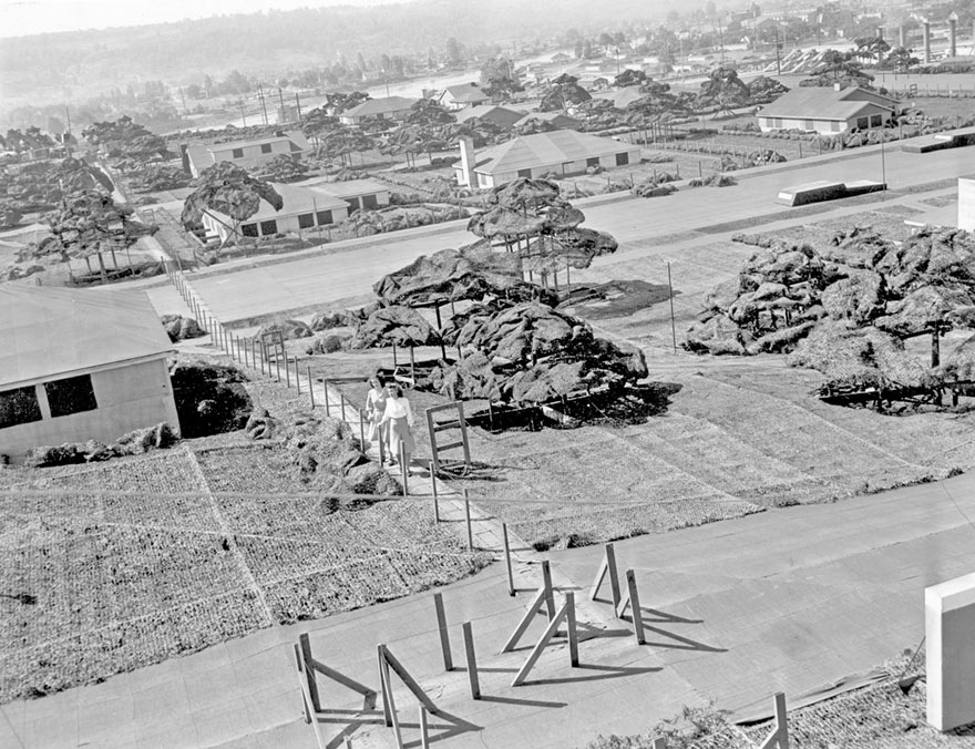
Joyce Howe, and behind her Susan Heidreich, walking over the camouflaged Boeing Plant 2
Image credits: Seattle Times archive
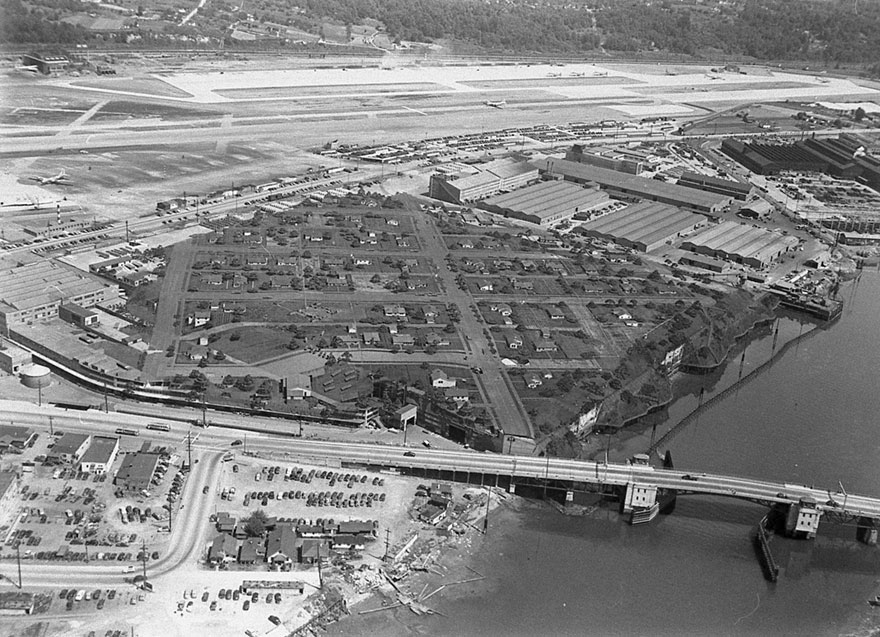
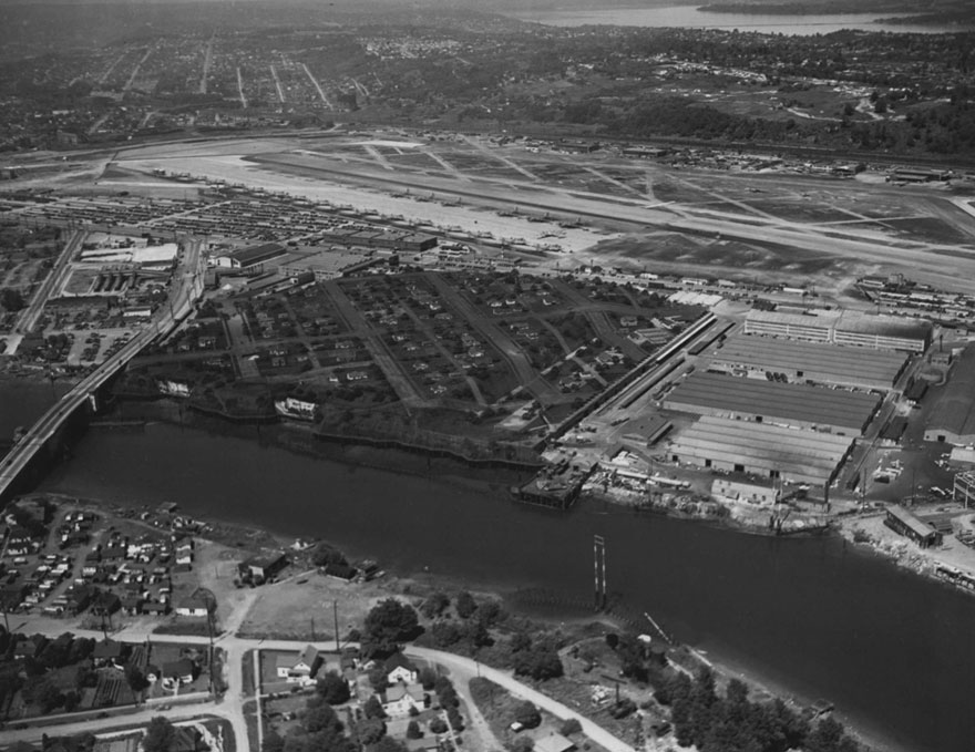
Boeing plant aerial photo taken from around 5000 feet. This was taken in either 1944 or 1945
Image credits: Seattle Times archive
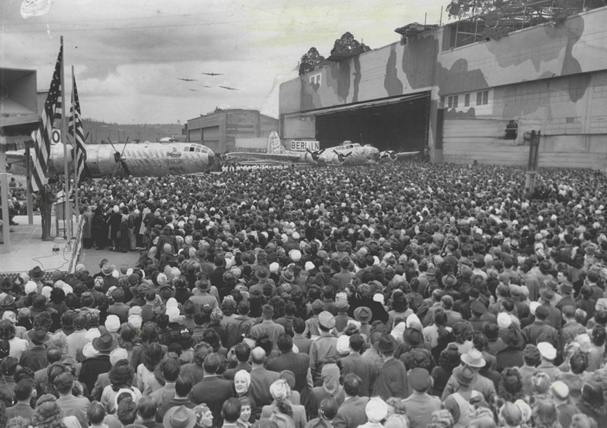
Thousands of Boeing workers gather in front of Boeing Plant 2 for ceremonies marking the changeover from B-17 to B-29 production on April 10, 1945
Image credits: Seattle Times archive
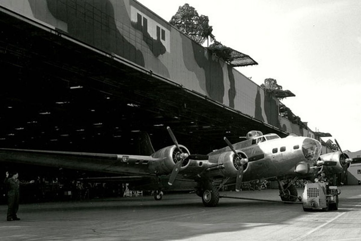
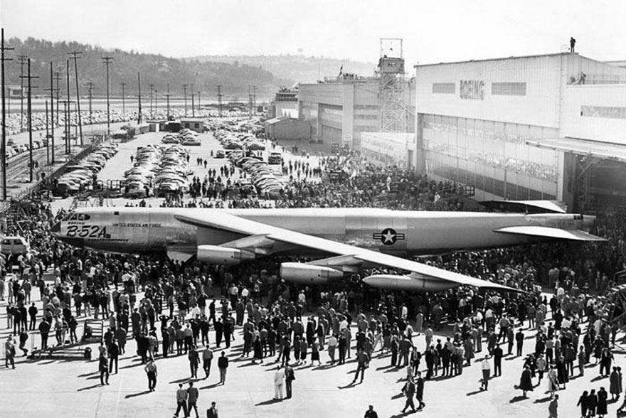
The first B-52A is rolled out at Boeing’s Seattle plant on March 18, 1954. In order to clear the hangar doorway, the plane’s 48-foot-high tail had to be folded down
Image credits: U.S. Air Force
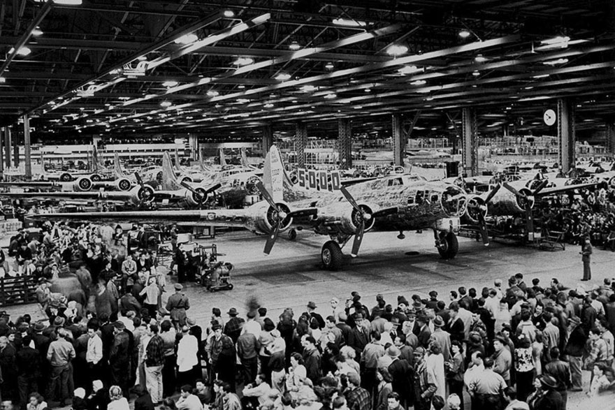
Boeing Plant 2. 5000th celebrations
Image credits: Seattle Times archive
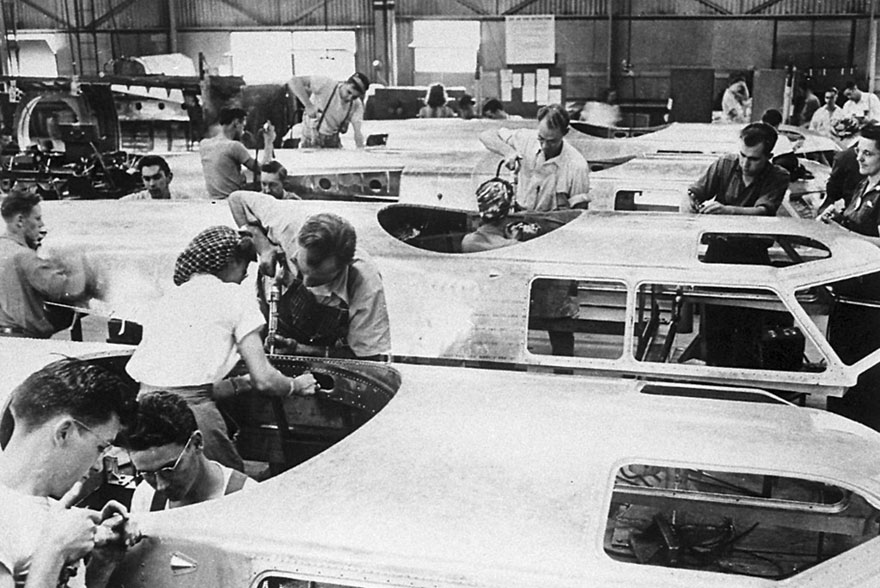
Boeing Plant 2. B-17G Flying Fortress cockpits under construction
Image credits: Bonneville Power Administration
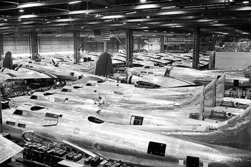
B-17F production line, Boeing Plant 2, July 14 1942
Image credits: Seattle Times archive
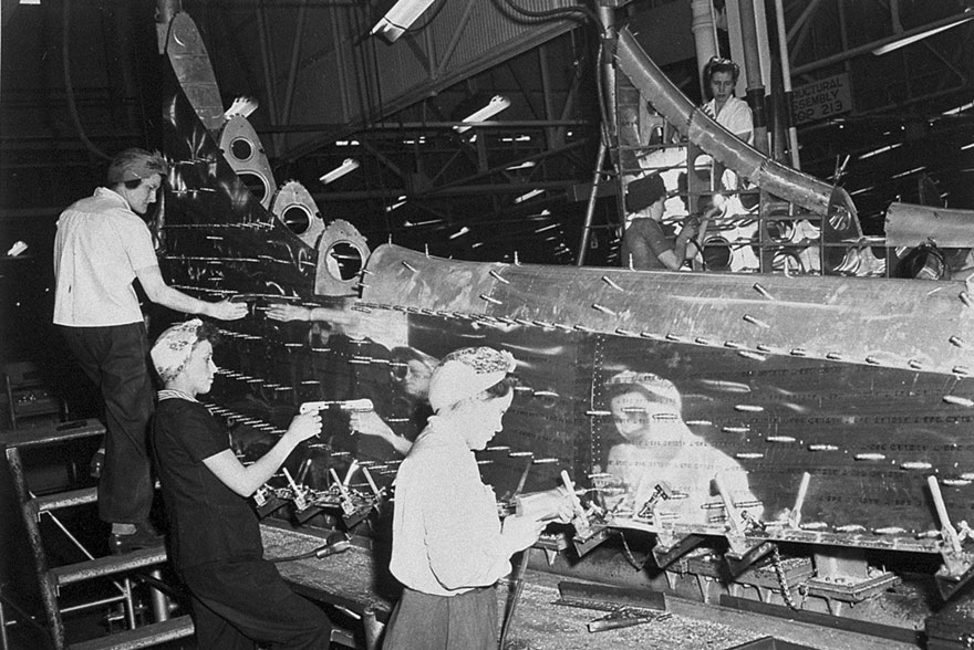
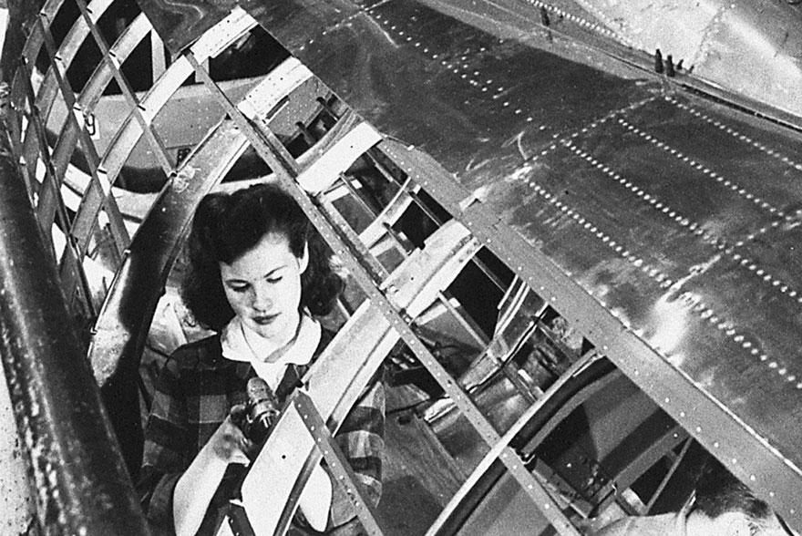
“Rosie the Riveter” at work at Boeing Plant 2
Image credits: Bonneville Power Administration
Image credits: Bonneville Power Administration
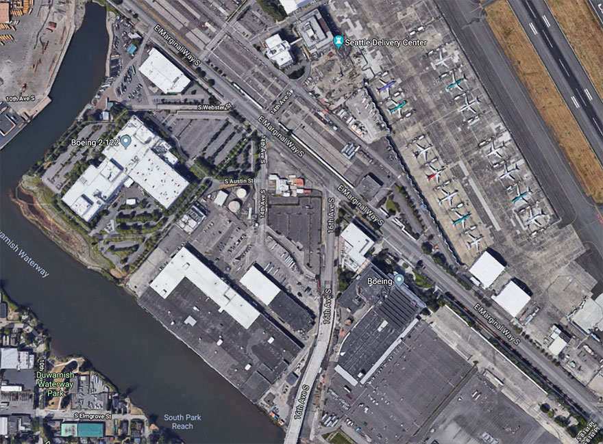
Here’s how it looks like now
Image credits: Google Maps
this is so cool. even cooler to see men AND women working side by side.
There are a lot of women working there becuase this is during WW II, and most men where soldiers
Load More Replies...In Naours France, there was a whole city underground which was used in time of war as A shelter. To arouse no suspicion they build a little house on top of it which could explain the smoke production. The enemies only saw A small house with smoke from the chimney. Little did they know, the smoke came from a whole town under the ground.
Just to be clear, because the OP doesn't say - this was back in WW1.
Load More Replies...I worked for two years at Integrated Coachworks here in Tulsa, OKl;ahoma. We bult school buses in a huge 1 mile long x 100 yard wide plant at the Tulsa International AIrport caled Bomber Plant #4. This building was used to build bombers for the US Military during WWII. It still has a golf course painted on it's roof from that time that was used to disguise it from aircraft overhead.
They STILLmake buses there...although the painted roof is gone. https://www.google.com/maps/place/Tulsa+International+Airport/@36.1899559,-95.8755353,695m/data=!3m1!1e3!4m5!3m4!1s0x0:0xa1434530be276422!8m2!3d36.198778!4d-95.8838659
Load More Replies...this is so cool. even cooler to see men AND women working side by side.
There are a lot of women working there becuase this is during WW II, and most men where soldiers
Load More Replies...In Naours France, there was a whole city underground which was used in time of war as A shelter. To arouse no suspicion they build a little house on top of it which could explain the smoke production. The enemies only saw A small house with smoke from the chimney. Little did they know, the smoke came from a whole town under the ground.
Just to be clear, because the OP doesn't say - this was back in WW1.
Load More Replies...I worked for two years at Integrated Coachworks here in Tulsa, OKl;ahoma. We bult school buses in a huge 1 mile long x 100 yard wide plant at the Tulsa International AIrport caled Bomber Plant #4. This building was used to build bombers for the US Military during WWII. It still has a golf course painted on it's roof from that time that was used to disguise it from aircraft overhead.
They STILLmake buses there...although the painted roof is gone. https://www.google.com/maps/place/Tulsa+International+Airport/@36.1899559,-95.8755353,695m/data=!3m1!1e3!4m5!3m4!1s0x0:0xa1434530be276422!8m2!3d36.198778!4d-95.8838659
Load More Replies...
 Dark Mode

 No fees, cancel anytime




















304
26